Revisiting My 30 Day Map Challenge, 2022
The 30 Day Map Challenge is upon us once again!
Instead of gathering ideas for this year’s challenge, I decided to procrastinate by having a look at my maps from last year to identify any patterns within my submissions - and perhaps even try and break them this year.
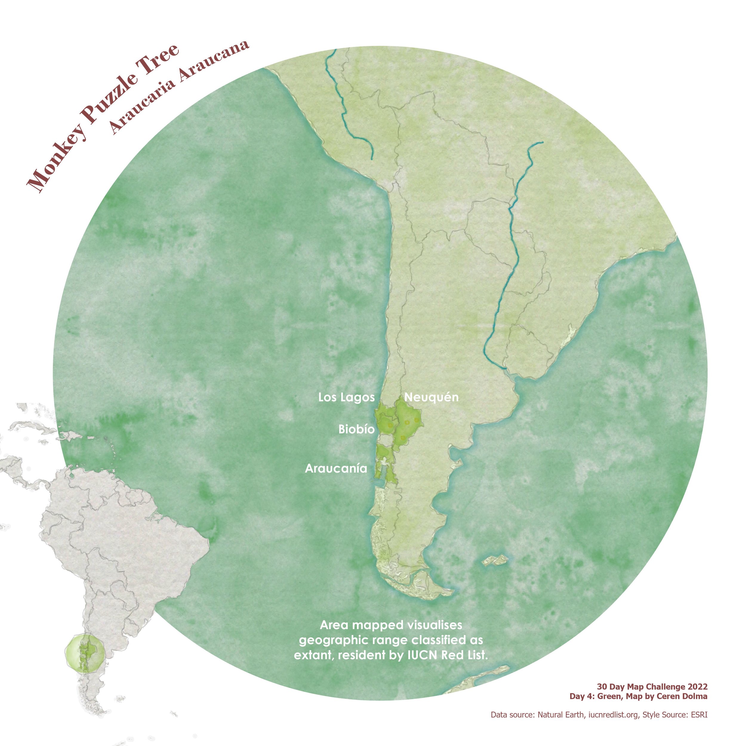
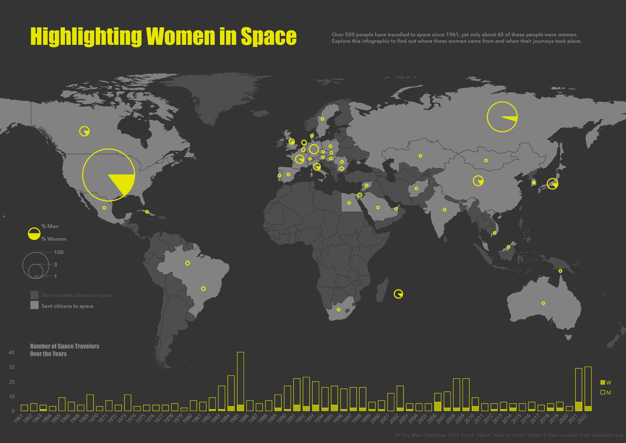
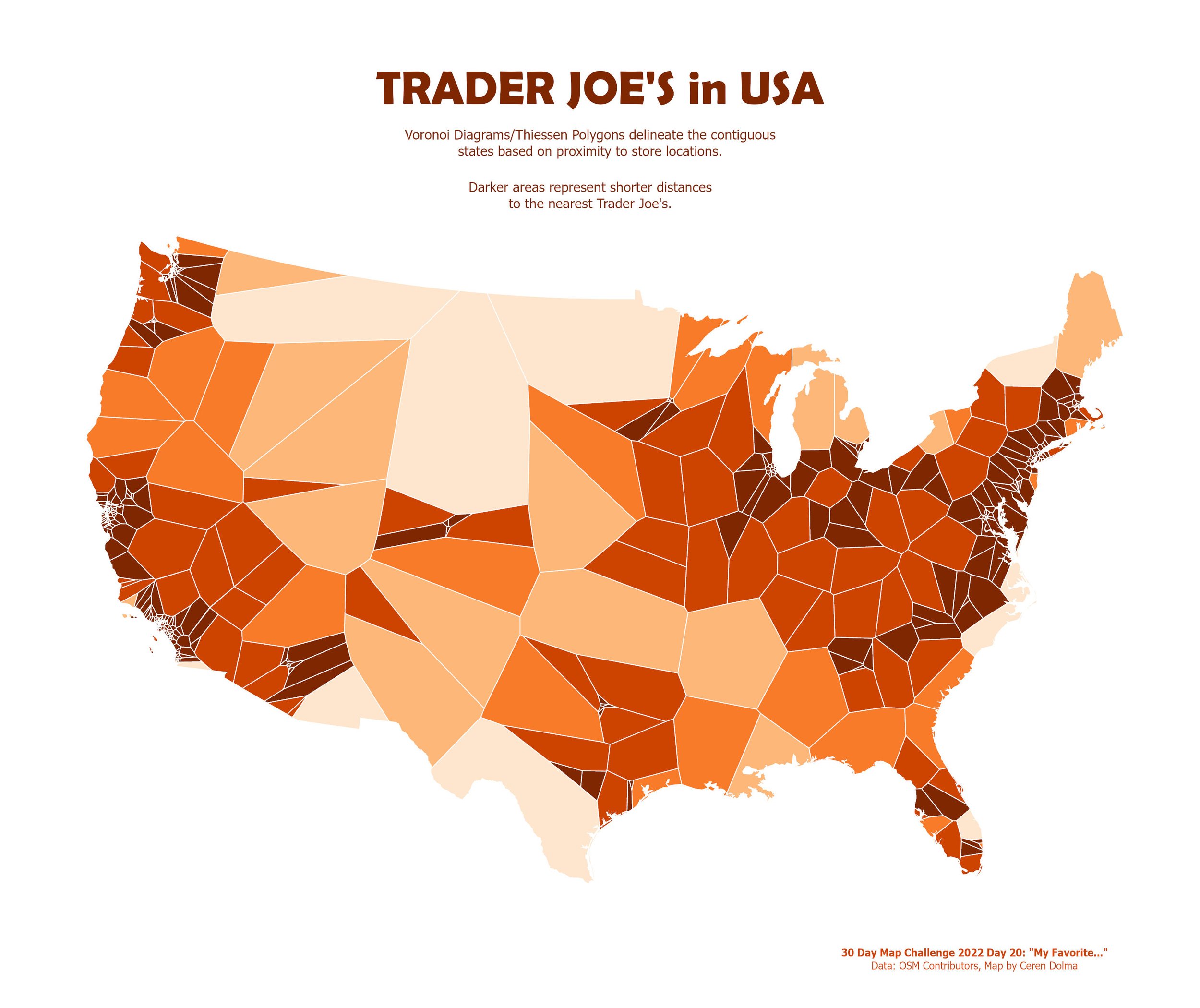
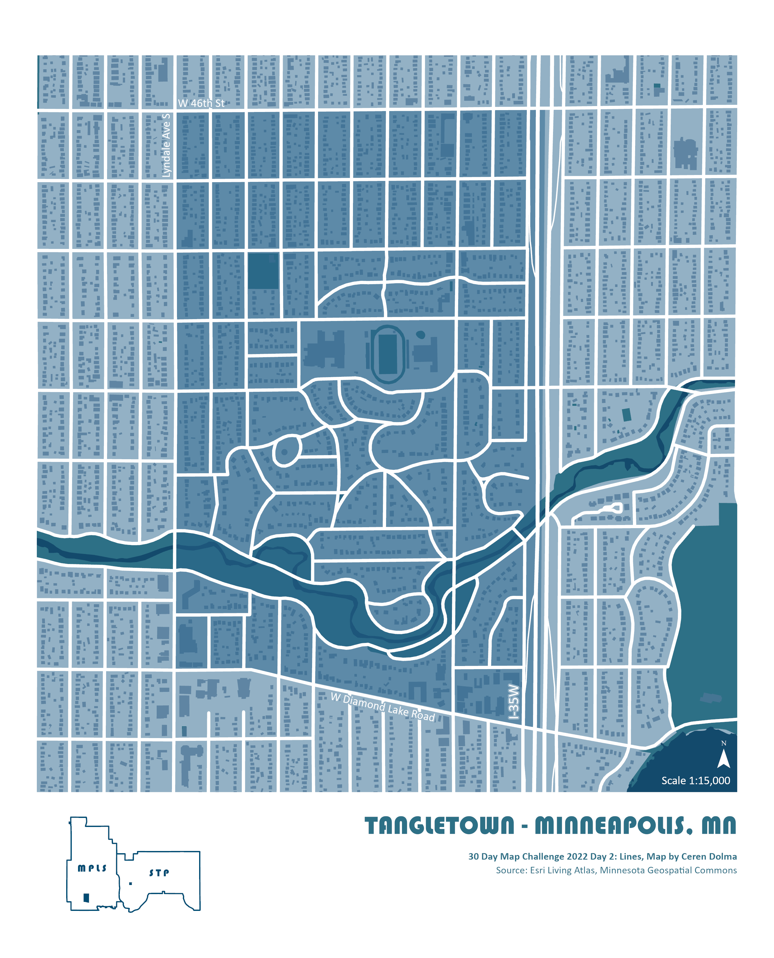
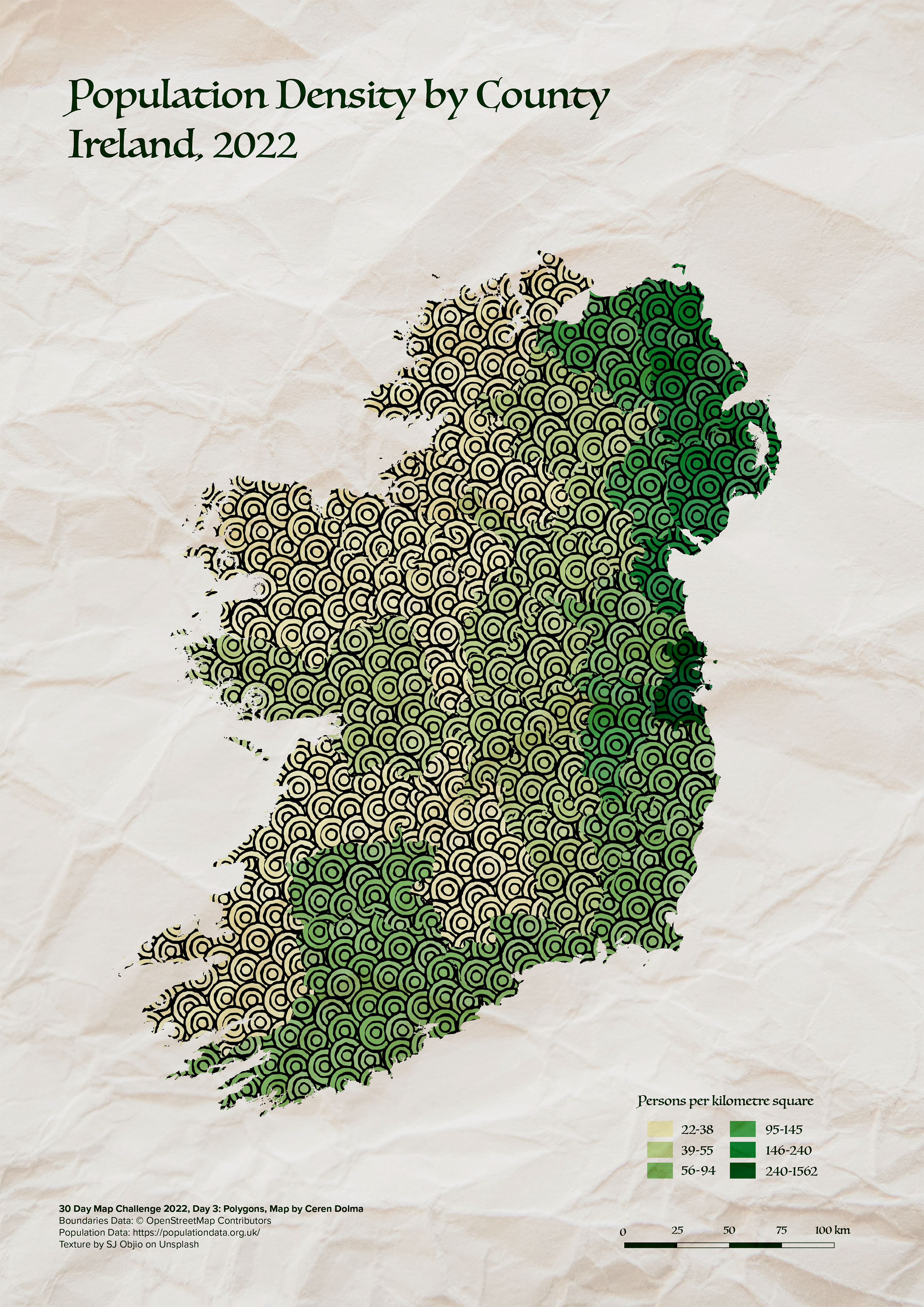
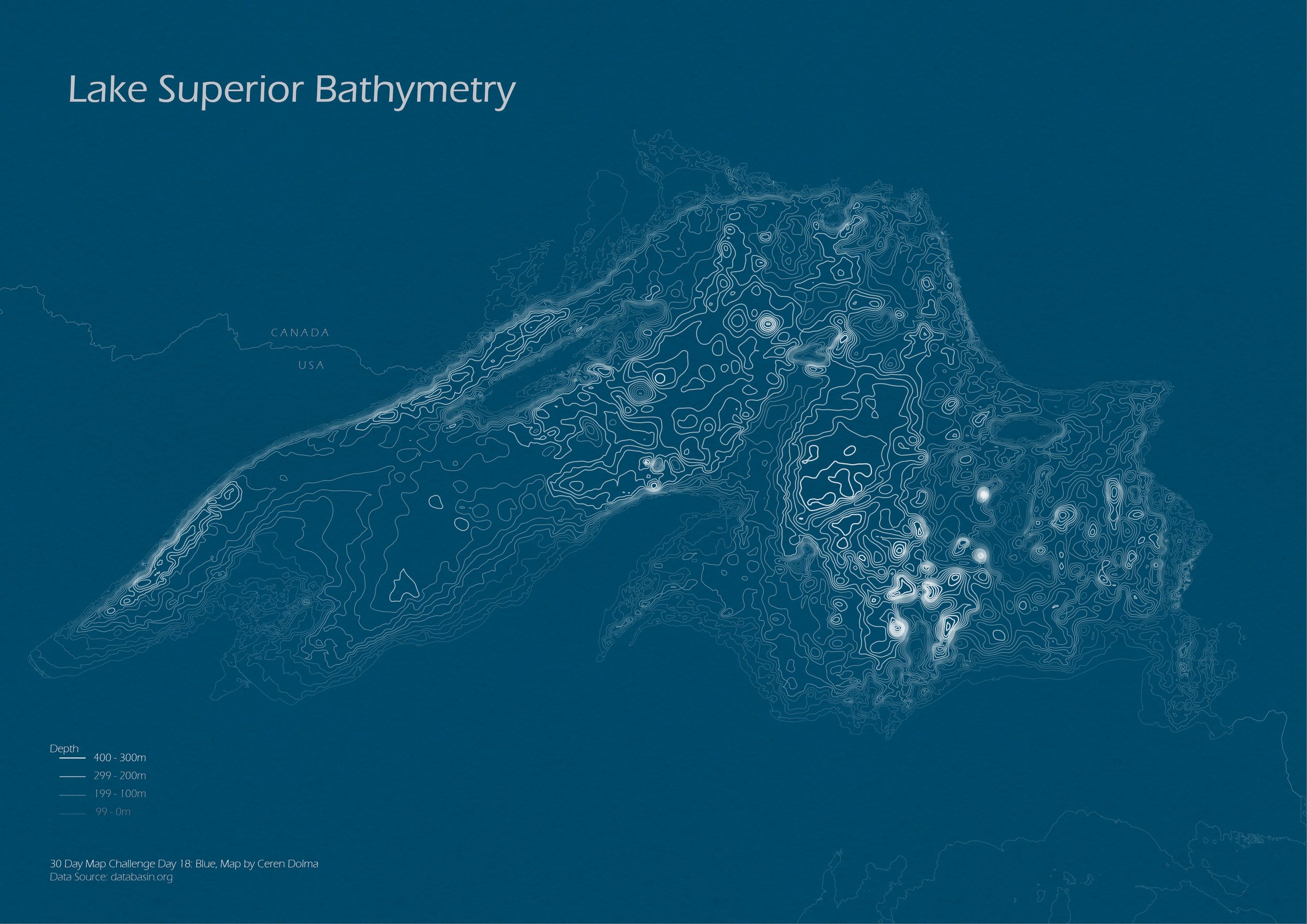
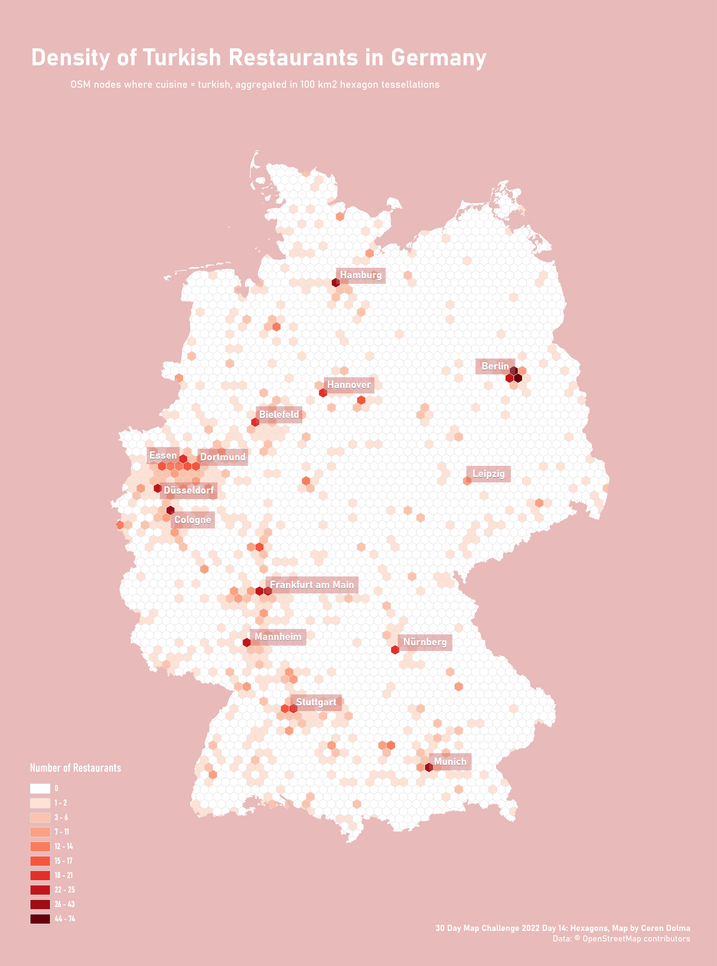
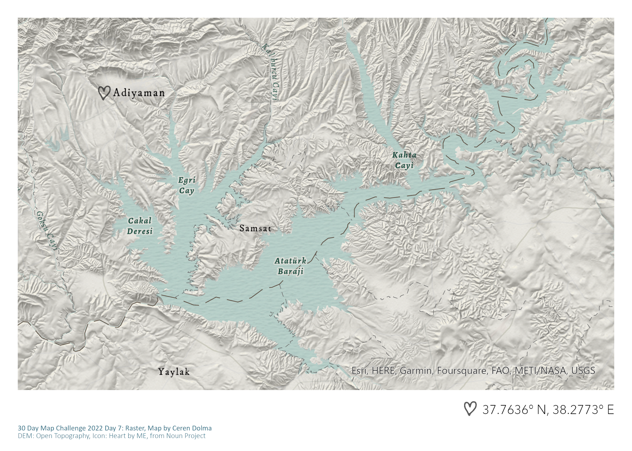
Here is a sample of maps from last year’s challenge below. Looking forward to this year’s challenge!
22/30 Maps Finished
Last year, I started off the challenge quite strongly and did not miss a day for the first 20. As life got busier, I dropped out a little and only managed to submit two more maps.
This year, I will be going through a move in the middle of the month, so I will definitely miss some days - which is fine because, for me, this challenge isn’t really about finishing a map every day, but it is about participating, meeting fellow map-makers, having fun, and maybe even learning a new skill or two along the way.
Popular Tools: ArcGIS Pro & Adobe Illustrator
My most used tools in last year’s challenge were ArcGIS Pro and Adobe Illustrator, which are both paid applications. I was able to do this because I was in a privileged enough position to have access to both, and it was often the easier choice as there are a plethora of resources and tutorials on these two tools as well.
For this year’s challenge, one of the intentions I am setting for myself is to use more open-source tools and data. I will probably still use Illustrator a good bit as I would like to get better at it. I also hope to use this as an opportunity to work more with R in the context of cartography!
Small Scale Maps - Covering Mostly Europe & North America
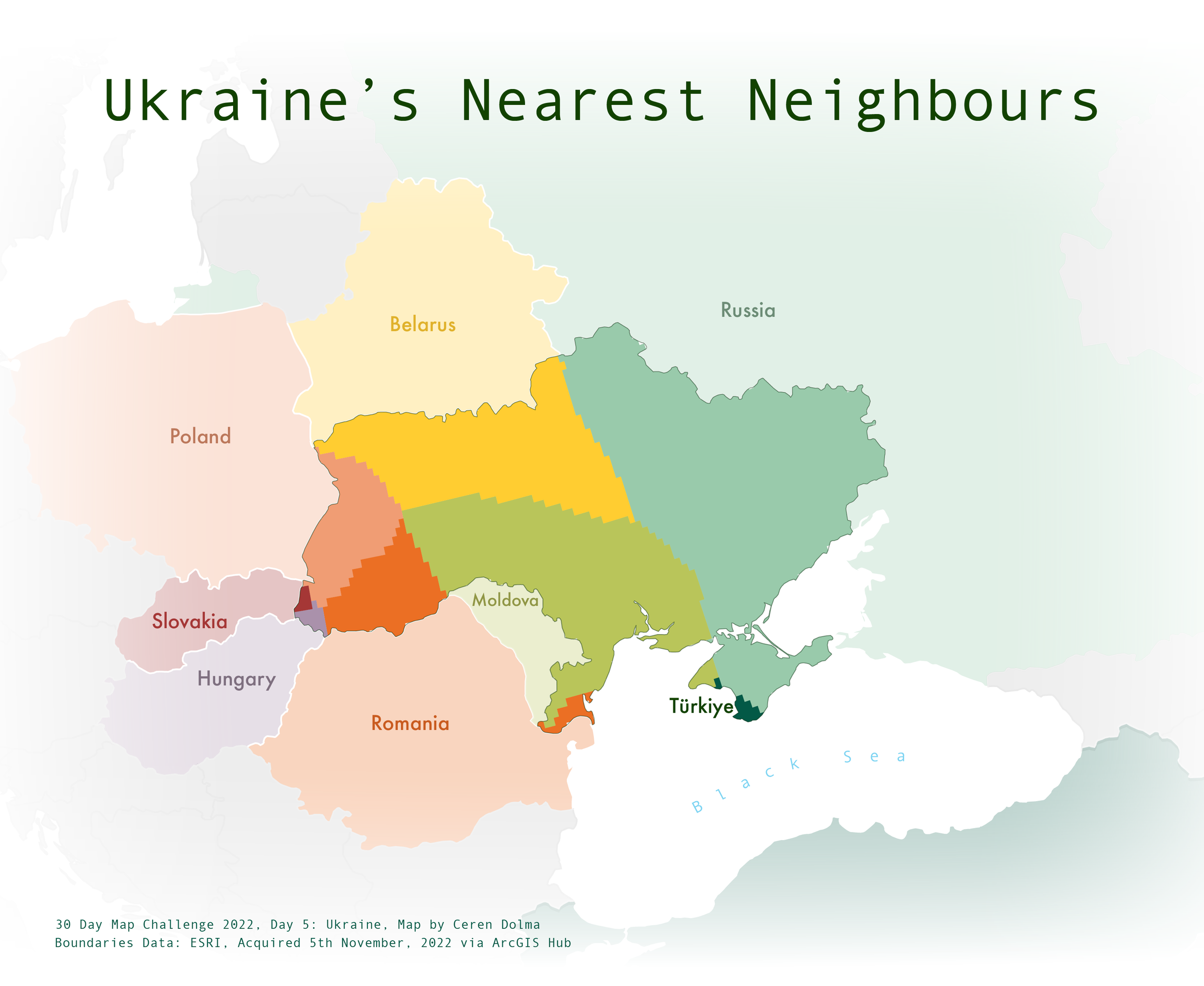
Looking at the extent covered in my maps last year, I notice that I am drawn to more generalised maps that cover larger areas. Part of the reason is that labelling is one of my least favourite aspects of cartography - so I tend to avoid extents, like neighbourhoods or cities, where I would need to pay more attention to labelling. Another goal for this year’s challenge is to befriend labels and make more large-scale maps!
One of the recurring themes for this year’s challenge is different Continents. Most of my maps last year focused on North America and Europe - which makes sense as these have been the regions I have spent the past 10 years in and have been the context of my cartographic education. This year, I would like to ensure that I participate in all continent-themed days and map areas I am less familiar with mapping, which will definitely come as a challenge when thinking of which projections to choose.